A few weeks ago, I talked with a friend who was considering purchasing a new home. She was excited to show me the pictures, pondering whether or not she could afford it, and trying to decide if it was the right fit for her. We talked a bit about the neighborhood where the house was located, which was a big selling point for her. And then the inner planning nerd in me came out. I asked if she had looked at the zoning in the neighborhood. She hadn’t, and who can blame her? Zoning is not usually something that comes to mind when you fall in love with a house.
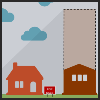
We went on to Portland Maps, typed in the address, and looked up the zoning map for the neighborhood. It turned out that the property behind the house, which was a small, older single family bungalow, was zoned “CS,” which means very little to most humans other than the planning nerds out there. I then explained that the CS zone allows for buildings that are 45 feet tall with possibilities for commercial and/or residential uses. In other words, the property behind the house could someday look very different than it does today. As if she already didn’t have enough to contemplate!
I bring this story up because it is something I think about a lot when working with neighbors experiencing change in their neighborhoods. Many of us fall in love with our homes and our neighborhoods because of how they are when we first experience them. It is difficult to imagine what changes might take place over time. If we don’t think about the potential for change in advance, when change occurs it can seem even more dramatic.
Just like financial literacy can be helpful when owning or renting a place to live, a little zoning literacy can also be helpful. If you haven’t done so, take a look at the zoning map for where you live. Look at how the properties are zoned and see what the code allows for height and number of housing units. See which properties are on lots that are zoned for higher intensity use. While this won’t give a picture of future architecture, this can give you an idea of the potential change in scale and density that could occur.
If you are a visual type (and if you need to entertain your children on a rainy day!), you could create a simple LEGO model of your neighborhood. Build it as it looks right now and then add more blocks to represent the potential changes in number of housing units and/or building heights. Again, this is not a perfect window into what may happen in the future, but it at least gives you a bit of a reference for what zoning allows.
Finally, you’ll want to pay attention to any potential zoning changes that might be proposed as the city updates its Comprehensive Plan (http://www.portlandoregon.gov/bps/57352). The draft zoning map will be released in May. While the vast majority of the properties in Portland will maintain the same zoning, there will be changes and you will have an opportunity to weigh in on whether or not these are changes you would like to see.
While you wait for the zoning map to be released, here are a few topics that you might want to pay attention to this month.
On The Radar for February
(1) Transportation System Plan: As part of the Comprehensive Plan update, the city is also updating its guide for transportation investments and policies. Included in this update is a list of project that has been ranked in priority. If you have thoughts about the plan and the prioritized projects, the Planning and Sustainability Commission will be hosting a public hearing and work session on February 24 at 3pm at 1900 SW 4th, Room 2500. Testimony may also be submitted at TSP@portlandoregon.gov. The public comment period closes on March 13.
(2) RICAP 7: The Regulatory Improvement Code Amendment Project (RICAP) is an annual project to update the city’s development codes. This year, there are 45 items under review. Items range from clarifying height measurements for shed roofs to issues related to landscape buffering between non-residential and residential zones. After an initial read, no huge items stand out to me, but you can learn more at an open house on February 7th, 5-7pm at 1900 SW 4th Ave, 7th Floor or at our next Land Use and Transportation committee meeting on February 16, 7pm, at 3534 SE Main.
(3) Demolition Code: On February 12th at 2pm, City Council will discuss proposed changes to the city’s code regarding demolitions in residential zones. Key provisions include:
- Definitions of “demolition” and “major alteration”
- Mandatory 35-day delay and notification period for all major alteration and demolition proposals
- An additional 60-day delay extension in cases where preservation, relocation, or deconstruction alternatives to demolition are being pursued
- Ability for any interested party to request the 60-day demolition delay extension
- Notice of all demolitions be provided to Architectural Heritage Center, Restore Oregon, Neighborhood Associations, and property owners within 150 feet of the site.
Also worth noting is that the new proposal also would require that whoever requests the delay pay a $1,318 fee, submit a plan for saving the property, and prove they have the financial means to carry it out.
By: Bob Kellett
Neighborhood Planning Program Manager
Southeast Uplift Neighborhood Coalition
(503) 232-0010 ext. 314
bob@seuplift.org